Lura River Retention Basins
Italy
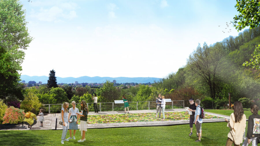
In Milan’s metropolitan area, the Lura River Retention Basins address the growing challenge of climate-induced flooding. By transforming a once mono-functional agricultural space and low-value wooded areas between Lomazzo, Cadorago, and Bregnano within Lura Park, we’ve crafted flood mitigation basins and new riverbanks using nature-based solutions.
Client
Parco del Lura
Geography
Status
Year
2019
Area Size
20 ha (total area); storage volume of 340,000 m³
Partners
Etatec, Studio Paoletti, Blu Progetti, Studio Idrogeotecnico Associato, Afra, Fabrizio Monza, STA Consulting, Koiné, Valeria Mezzanotte
Key project datas
10.000 m² of dust-free cycle paths, 480 square metres of wooden lakeside, 3 rest areas, 2 birdwatching points, 21.200 square metres of naturalistic reforestation (1.057 trees + 1.296 shrubs), 13.900 square metres of reforestation with tree crops (698 trees + 850 shrubs), 2.500 m of rows of vines (416 trees), 6.900 m² of river rehabilitation (8.000 shrubs)
ph. Nicola Colella
ph. Nicola Colella
ph. Nicola Colella
ph. Nicola Colella
ph. Nicola Colella
ph. Nicola Colella
The project was conceived to mitigate the flooding affecting Milan’s metropolitan area during heavy rains, which are becoming increasingly frequent and extreme due to climate change.
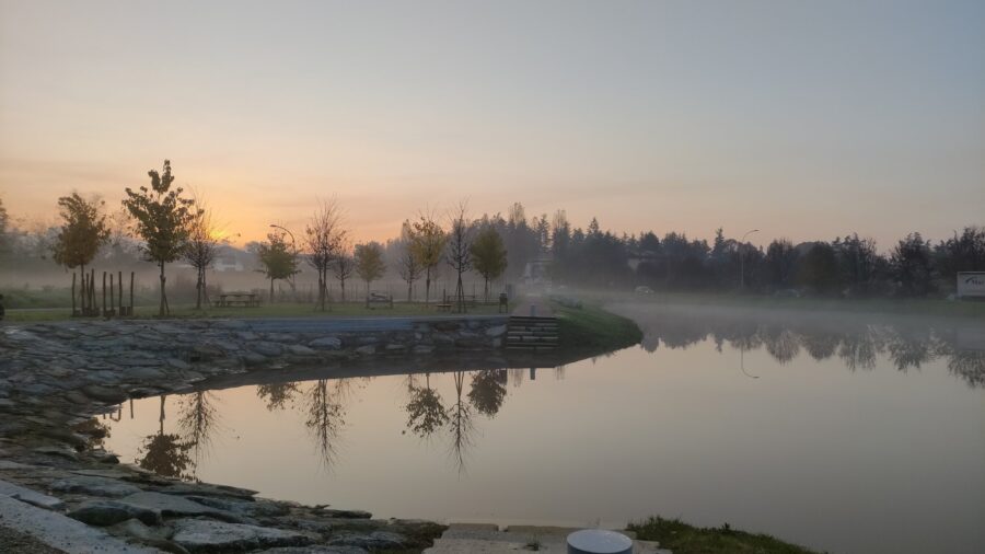
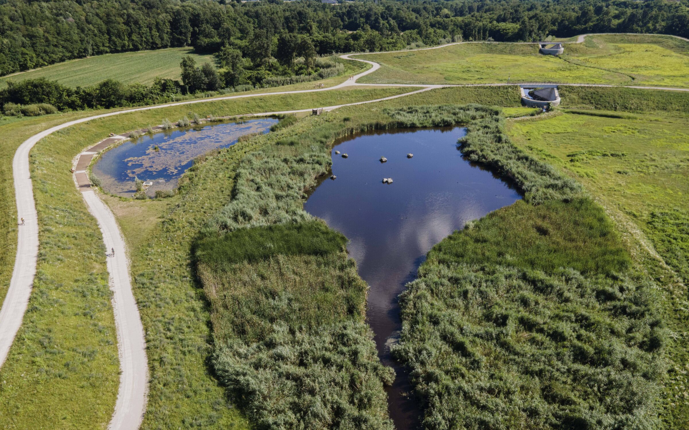
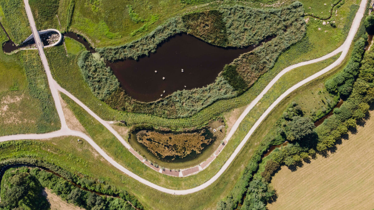
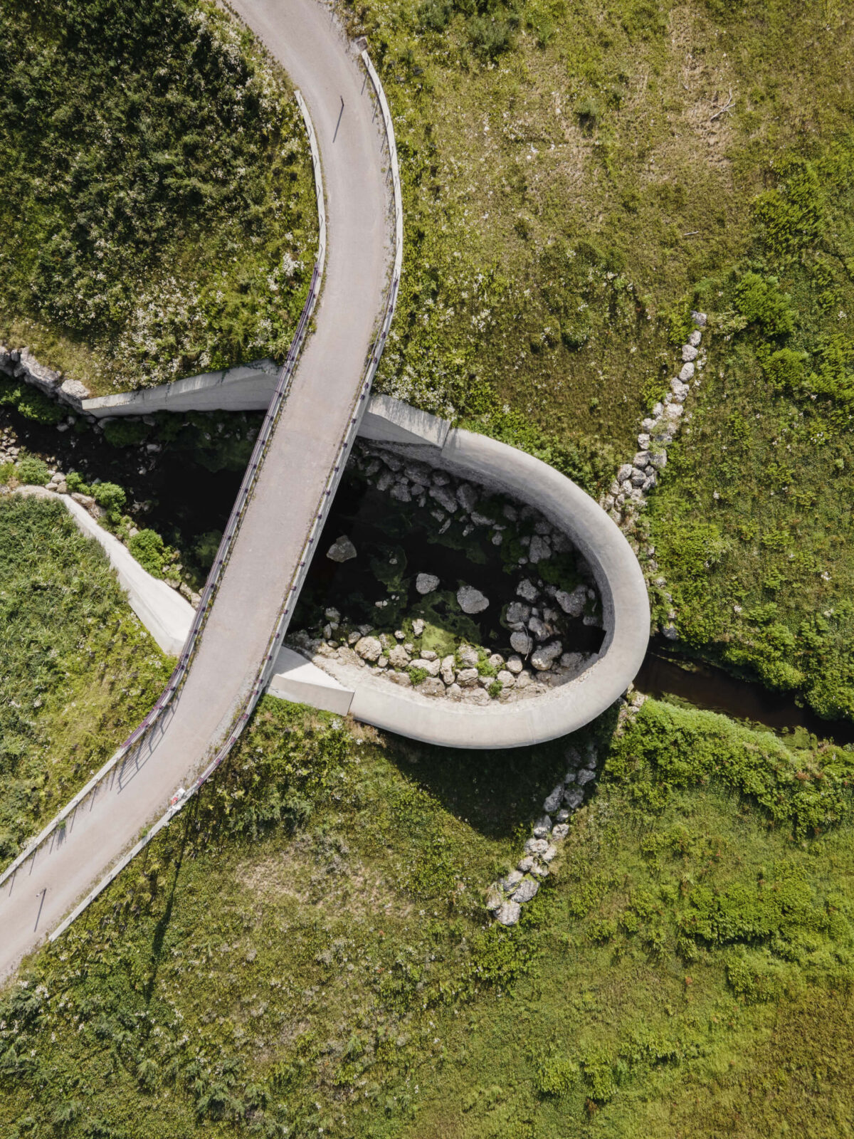
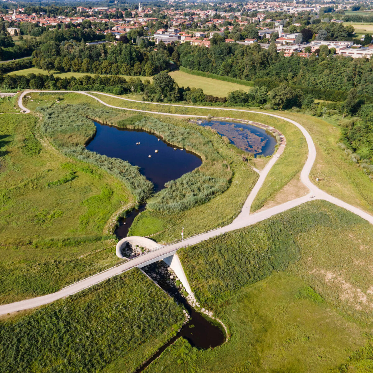
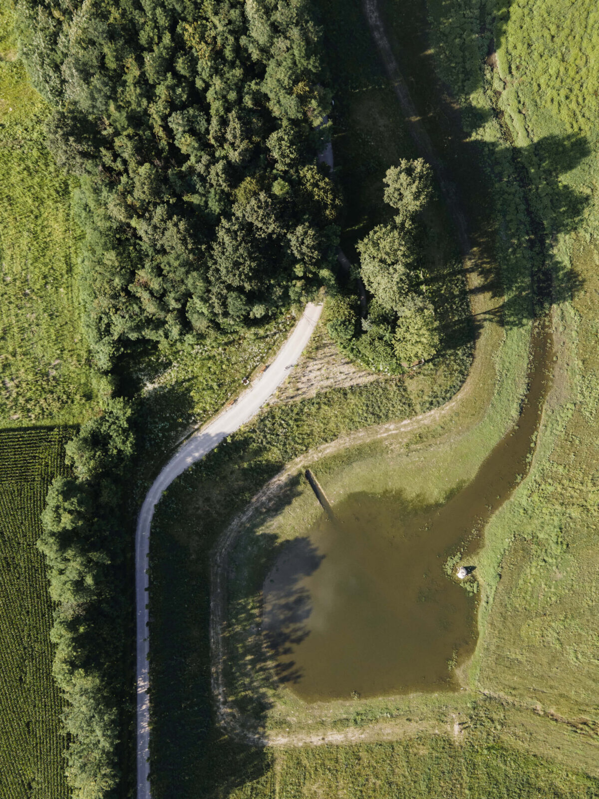
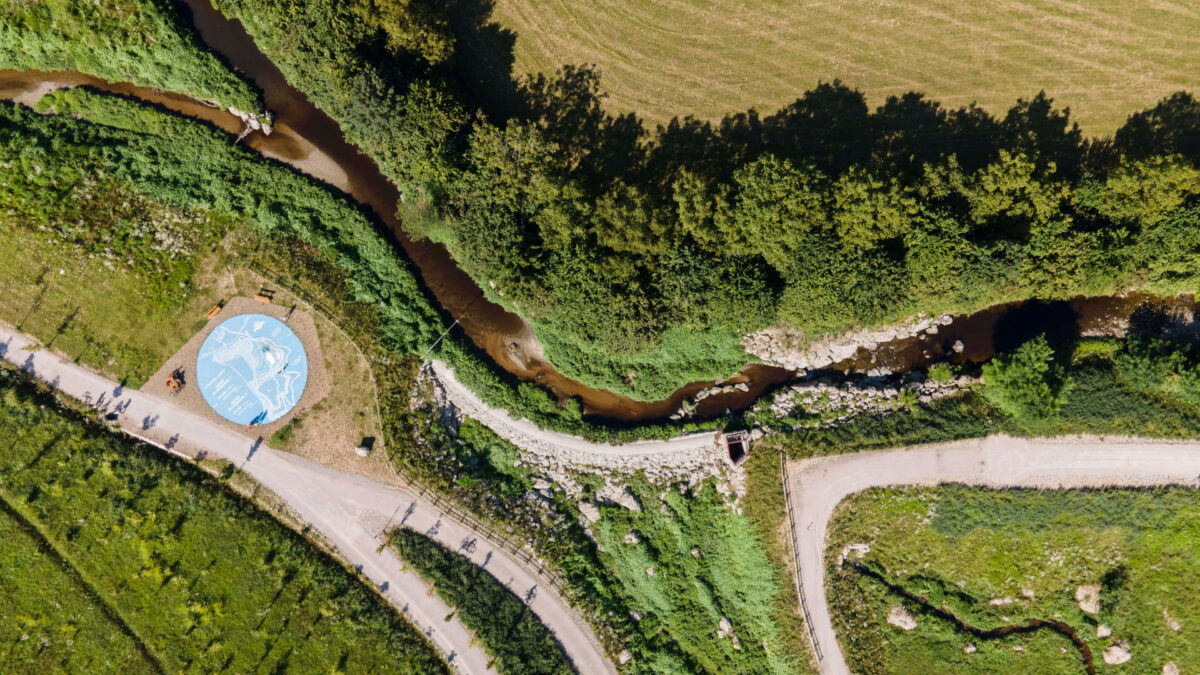
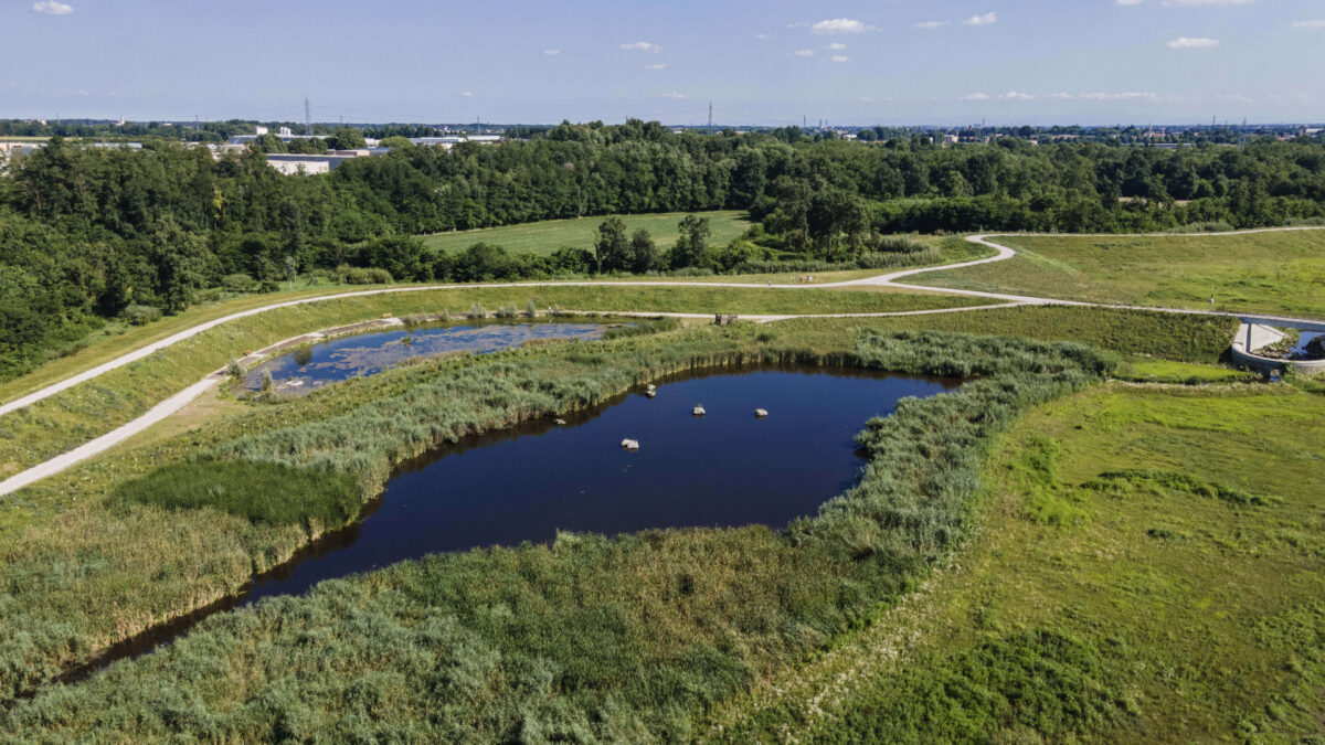
The Lura River Retention Basin stands out for its innovative approach, transforming a mono-functional agricultural area and wooded strips with low ecological value into a sustainable solution. Located between the municipalities of Lomazzo, Cadorago, and Bregnano within Lura Park, the project involved the construction, using naturalistic engineering techniques, of new banks and flood lamination basins along the course of the Lura River.
The project is part of a supra-regional strategy of hydro-geological risk reduction. It is an application of the Lura Stream Subbasin Project promoted by the Interregional Agency for the Po River (AIPO) and the Lombardy Region, which co-financed the work.
Thanks to two basins designed to collect water from the stream in the event of flooding and to the adjacent pond fed with groundwater, a permanent wetland with hygrophilous vegetation has been created. This aims to create an ideal habitat for the settlement of various animal species, such as the little bittern (Ixobrychus minutus) and the white heron (Ardea alba), which have appeared due to the intervention.
The basins’ hydraulic functioning is based on the principle of gravity. This factor has made it possible to avoid impacting land consumption by constructing particularly bulky engineering works such as pumping stations.
Native species have been used for reforestation to increase the area’s ecological value.
Vegetation
3171 trees
20146 shrubs
River rehabilitation
6900 m2
SDG's
Goal 4.7,
Goal 6.6,
Goal 9.1,
Goals 11.5, 11.a
Goals 15.1, 15.3, 15,5 and 15,9