Urban Biodiversity Mapping
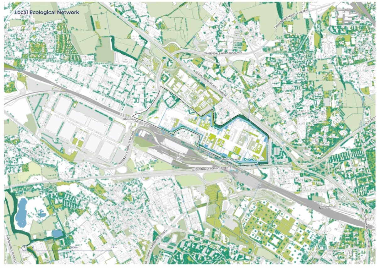
Today's challenges related to climate change and biodiversity loss in urban spaces should be tackled as a local, regional, and global emergency by designing with nature. Cities are called on to lead the conservation of biodiversity and to implement it in urban open spaces. Identifying the environmental, cultural and social values and potentials of urban biodiversity through visuals and maps is part of LAND's mission within the T-Factor project's experiment (2021 to 2023) in the Milan Innovation District, in collaboration with the Polifactory team from Politecnico di Milano and wildlife experts from Studio TerraViva.

Insect observations (Credits: LAND, Polifactory)
The main goal of biodiversity mapping in urban areas is to support decision-makers and policymakers in choosing strategies aimed at preserving and improving nature, as described by the development goals of the European Commission’s Biodiversity Strategy 2030. This applied research also encompasses the European Council’s objectives of addressing the direct and indirect causes of biodiversity and natural resource loss within landscapes and reiterates the need to fully integrate biodiversity objectives into other sectors, including urban planning and real estate management.
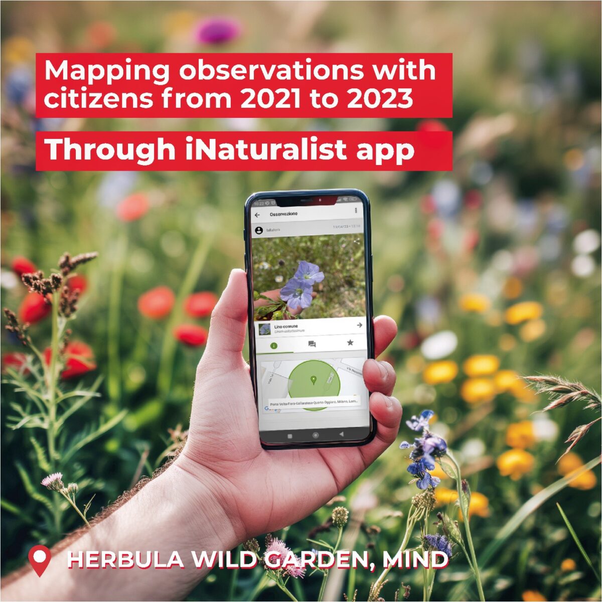
Integration of citizen-science tools for urban biodiversity mapping, such as I-Naturalist (Credits: LAND)
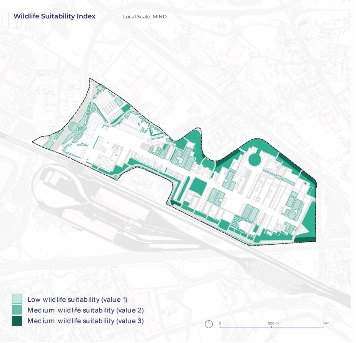
The biodiversity mapping carried out within T-Factor helped create a cutting-edge service for evaluating ecosystem services, assuring that the environmental features of urban spaces would encourage biodiversity. This approach assesses thematic data and provides new cartographic information through science-based reporting in tandem with citizen-science mapping tools. The integration of species recognition and monitoring tools (such as geo-referenced open-source data, photo traps, sensors, and image recognition devices) into an integrated mapping workflow makes it possible to collect information about local flora and fauna in a faster, more accessible way for everyone.
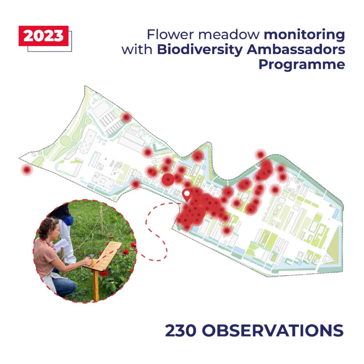
Biodiversity Mapping observations (Credits: LAND)
In LAND’s vision, integrating data gathering with digital technology and citizen-engagement practices can make biodiversity mapping more accessible and agile in the uncertainty of urban regeneration. This approach enables the participation of a plethora of stakeholders (both experts and non-experts, as well as owners and users) in a data-based incremental learning practice. Moreover, biodiversity mapping can help activate communities in maintaining green spaces and raise awareness of biodiversity issues, thus influencing public space design.